Severe storms rolling into Chicago area from Wisconsin amid hot Saturday
Strong storms are moving into the Chicago area from Wisconsin and could bring damaging winds, hail, and torrential rain.
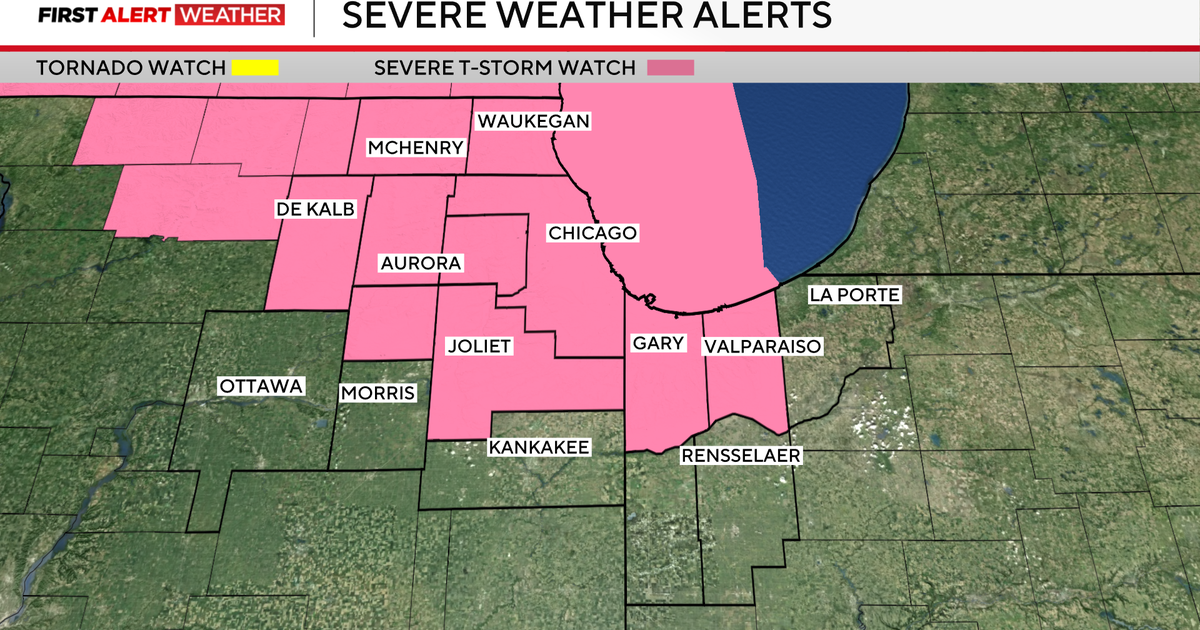
A severe thunderstorm watch has been issued through 7 p.m. for Cook, DuPage, Kane, McHenry, Kendall, Lake, Will, and DeKalb counties in Illinois; and Porter and Lake counties in Indiana.
A severe thunderstorm warning also has been issued for parts of Cook, DeKalb, and Kane counties until 4:45 p.m. Another severe thunderstorm warning is in effect for parts of Cook and DuPage counties until 5 p.m., and a severe thunderstorm warning also has been issued for parts of DeKalb and Kane counties until 5:15 p.m.
A dust storm advisory also was issued for DeKalb, DuPage, Kane, Kendall, LaSalle, Lee, and Will counties until 5:30 p.m., after blowing dust was spotted along a line extending from Carol Stream to near Shabbona to near Franklin Grove, moving south at 25 mph.
The blowing dust could reduce visibility to less than one mile, with strong winds of more than 50 mph, making for dangeroust travel along the following interstates:
- I-39 between mile markers 68 and 96.
- I-55 between mile markers 255 and 269.
- I-88 between mile markers 55 and 73, and between mile markers 93 and
- 132.
- I-355 between mile markers 10 and 30.
Drivers should not drive into an area of blowing dust, but instead should pull over and wait for the dust to pass.
Strong storms with wind gusts of up to 60 mph began moving into northern Illinois from Wisconsin around 3 p.m.
The waves of storms will be aggravated by the heat in Chicago, where temperatures reached the mid 90s on Saturday afternoon.
The Woodstock Fire/Rescue District said they responded to multiple calls for downed wires after storms started moving through. Officials warned people to assume any downed wires are powered and dangerous, and to stay away. Motorists should never drive over or try to move downed wires in their path.
Waves of strong storms are expected to continue through around 7 p.m. before moving off to the southeast.
More heavy rain and storms are possible Sunday morning before things calm down later in the day.
Todd Feurer is a web producer for CBS Chicago. He has previously written for WBBM Newsradio, WUIS-FM and the New City News Service.