Overnight storms bring flooding risk
A flash flood warning is in effect for much of the Kansas City metro area through 4:45 a.m. Thursday. The National Weather Service says storms have already dropped 1 to 3 inches of rain, with another 0.5 to 2 inches possible overnight. Rain and scattered thunderstorms will remain likely through the early morning hours.The heaviest rainfall is expected between midnight and 7 a.m., possibly impacting the Thursday morning commute. Conditions will gradually improve by late morning.Thursday will be much cooler, with highs around 79 degrees. Rain is likely through midday, but drier conditions are expected in the afternoon. Heat returns this weekend, with highs climbing into the mid-90s and possibly reaching 100 degrees by midweek.
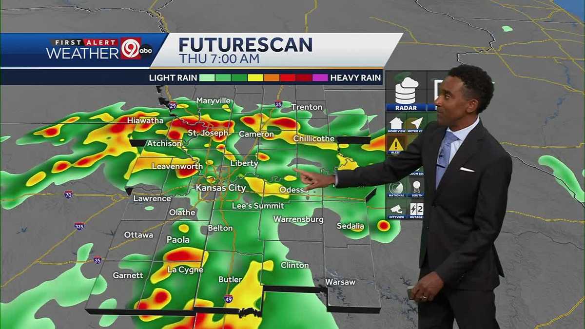
A flash flood warning is in effect for much of the Kansas City metro area through 4:45 a.m. Thursday.
The National Weather Service says storms have already dropped 1 to 3 inches of rain, with another 0.5 to 2 inches possible overnight.
Rain and scattered thunderstorms will remain likely through the early morning hours.
The heaviest rainfall is expected between midnight and 7 a.m., possibly impacting the Thursday morning commute.
Conditions will gradually improve by late morning.
Thursday will be much cooler, with highs around 79 degrees.
Rain is likely through midday, but drier conditions are expected in the afternoon.
Heat returns this weekend, with highs climbing into the mid-90s and possibly reaching 100 degrees by midweek.