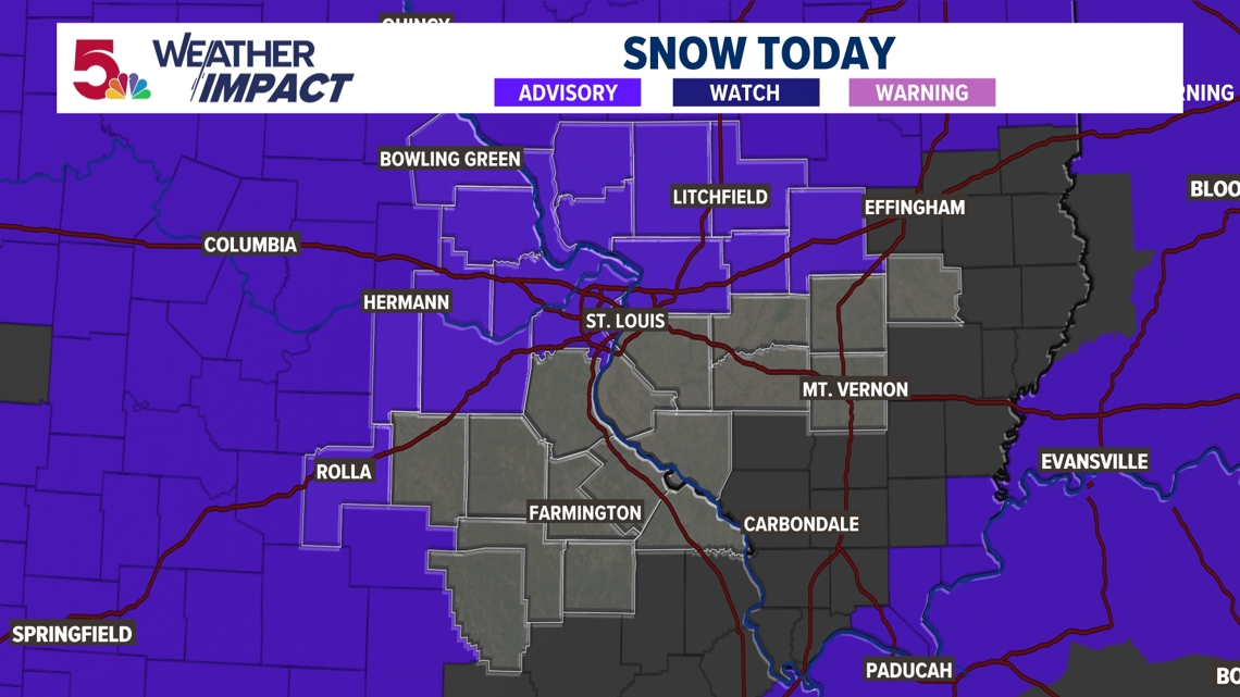
Weather Impact Alert: Snow for Monday afternoon, evening
2-3″ of snow are expected in most spots today, with lower totals to the south.
ST. LOUIS — Another round of light snow is on the way this afternoon. While this snow will still have impacts on the region’s travel as we expect accumulating snow, it will be quite a bit different than the storm we had on Saturday in the area.

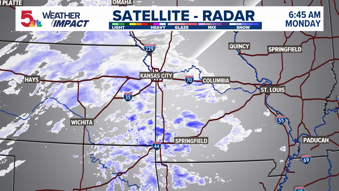
First of all, let’s take a look at the system that will deliver the lighter snow this afternoon. It’s not quite as organized or impressive as Saturday’s was. One thing to notice from this system: more of the snow is banded. While a majority of this snow is very light, we will see a few pockets of more moderate snow. This is where we’re going to see most of our accumulation throughout the day.

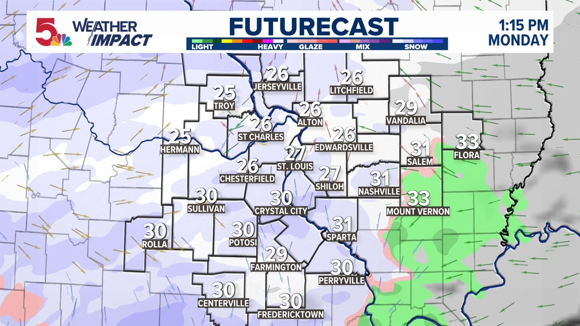
Light snow begins after noon as temperatures remain below freezing. Light snow will persist through the majority of the afternoon and evening, with even some light sleet mixing in near Farmington, and our southern areas.

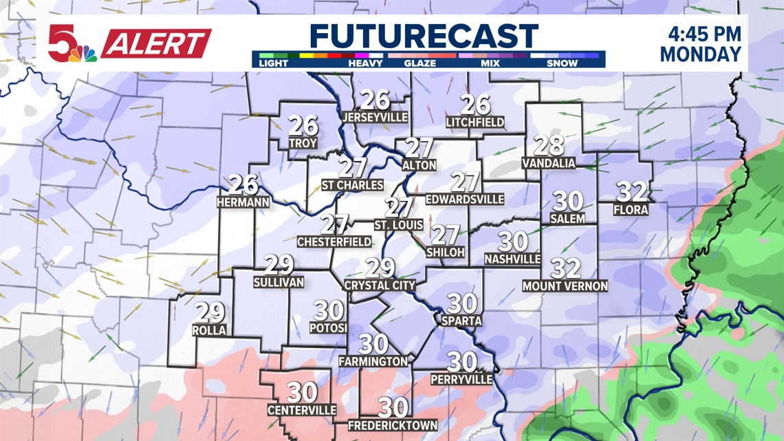
By the evening commute, light snow is persistent in the area, with a little bit of sleet to the south. Because of the timing of this snow, regardless of how heavy it will be, the rush hour is going to be slower.


Because of the timing of this storm, during a period where most everyone is back to work or school, a Weather Impact Alert has been issued for this afternoon. Expect slick roads and travel delays, but they will not be as major as they were on Saturday morning.

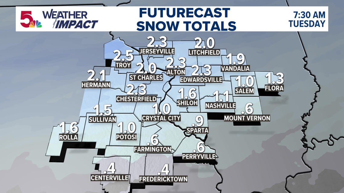
For most of us, we are getting between 1-2″ of light and fluffy snow. If more sleet mixes in to the south, our snow totals will be less than they will be to the north, where light snow is persistent. The only way to see a bit more, is if we see slightly heavier bands develop to the north. Regardless, a 3″ maximum total is expected, area wide.

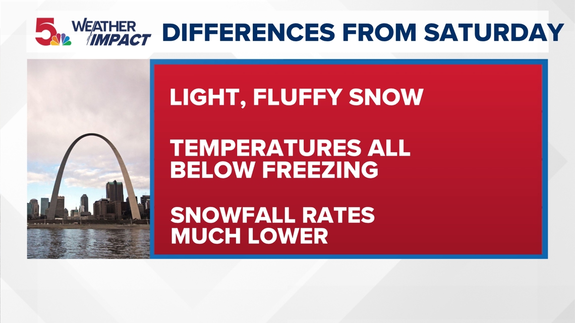
The main differences from Saturday will be that our snowfall rates are much lower than what we encountered during the morning. Temperatures will also be well below freezing throughout the day, so any snow that falls will stick quickly. This snow will also be low moisture content snow, which means it will be light and fluffy. You can clear this snow with a leaf blower or brush it away with your glove on the windshield. Bottom line: not as many widespread impacts, but spots will definitely be slower to travel.
5 On Your Side meteorologists will use Weather Impact Alerts to let you know when impactful or dangerous weather is expected as soon as there is confidence in disruptive weather happening in our area.
Download the free 5 On Your Side app to get the latest watches and warnings and track conditions live with our interactive radar. Use the links below to download now.
5 On Your Side news app
iPhone | Google Play
To watch 5 On Your Side broadcasts or reports 24/7, 5 On Your Side is always streaming on 5+. Download for free on Roku or Amazon Fire TV.