New Hampshire weather: Sunny Monday, Snowy Tuesday
A weak system with snow/mixing north and mixing/rain south will wrap up this evening but could result in additional slick spots for some(especially north) into the night. The first statewide snowfall is likely on Tuesday with 4 to 8 inches of snow possible for many.
LINGERING TRAVEL IMPACTS
Temps will fall into the upper 20s to low 30s overnight with some clearing in southern areas. Even though the steady rain and snow has moved out, some slick spots are likely to start the day Monday. The breeze will pick up a bit by morning.

>> Download the free WMUR app to get updates on the go: Apple | Google Play <<
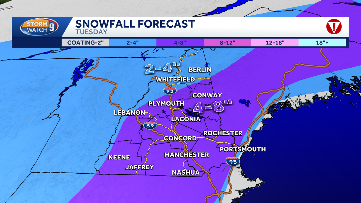
TUESDAY ACCUMULATING SNOW
After a brisk and sunny day Monday, the next storm system is Tuesday. The latest computer models show the storm arriving a little sooner, with snow filling in south between 7 and 9am.

A Winter Storm Watch is issued from Tuesday morning through late Tuesday night for most of New Hampshire except for parts of Grafton County and Coos County.

It will continue all day with the heaviest bands by afternoon and evening. It ends quickly by midnight.
We’re expecting between 5 to 10 inches of snow for most areas, including Manchester, Concord, and Nashua. Lesser amounts north of the White Mountains and possibly right at the coast.

>> Subscribe to WMUR’s YouTube channel <<
Be weather-aware! Download the WMUR app for Apple or Android devices and turn on push notifications. You can choose to receive weather alerts for your geolocation and/or up to three ZIP codes. In addition, you can receive word when precipitation is coming to your area.
Get storm coverage through the free Very Local app on your smart TV.
Follow the Storm Watch 9 team on social media: